
Here are a variety of maps and aerial views of our property:
- Trails Map
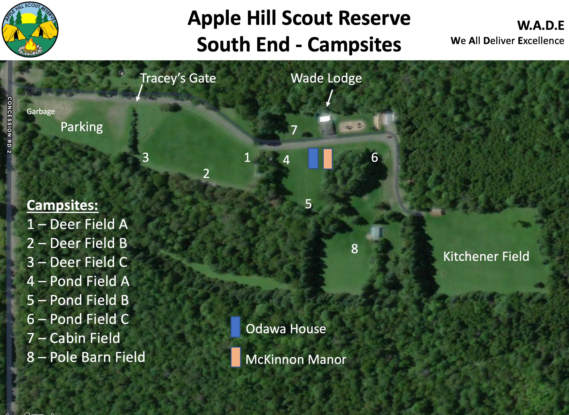
- South End Camp Sites
- Aerial View (c/o Google Maps)
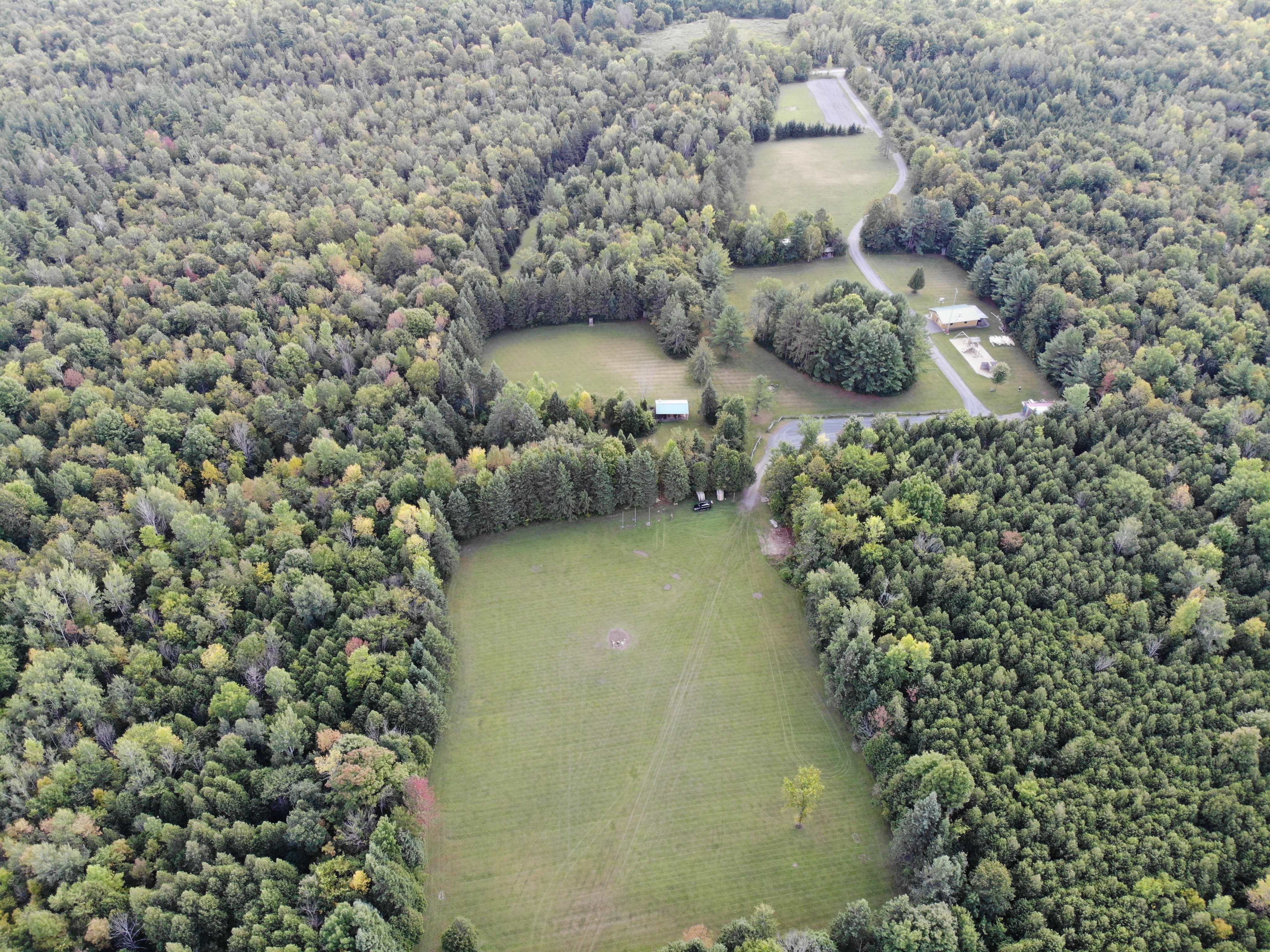
- Aerial View (South end) (c/o Bryan Ladds Sept 2018)
- Aerial View (South end)
- Graphic map (South End)
- Graphic map – greyscale (South End)
Map with lots of GPS Waypoints: kybos, activity fields, firepits, lodging, shelters, points of interest, trailheads (some)
Bryan Ladds has started to compose an orthoscopic map of AHSR. Here’s the draft which shows the South Gate to Kitchener Field in high definition. Zoom in to see the impact and it’s almost 3D. http://arcg.is/SKTmz
Want to know what the South End of AHSR looks like? The above pictures help and here’s a short video showing the view from the Main Road and into Kitchener Field. You’ll see Villeneuve Field, then Deer Field, a quick view of Wade Lodge before turning into the Visitor Parking and entering Kitchener Field. South End – video. Thanks to Bryan and John Ladds for the video.